

Commercial & Development Surveying in Oregon City, OR
Commercial development depends on accurate data, clear documentation, and careful coordination with local agencies. At Township Surveys, we provide commercial land surveying for developers, property owners, lenders, attorneys, engineers, and municipalities that need dependable information before moving a project forward. Since 1972, our team has handled complex boundary, development, and legal survey work throughout the region. We combine modern surveying technology with decades of local knowledge, helping clients reduce risk, satisfy planning requirements, and avoid expensive delays caused by incomplete records, disputed boundaries, or inaccurate site information.
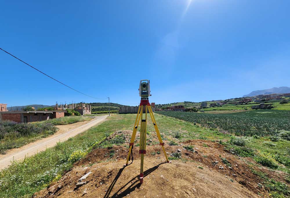
Surveying That Supports Better Development Decisions
A commercial project can involve far more than measuring a parcel. Developers may need to confirm boundaries, document easements, map site conditions, prepare legal descriptions, coordinate with city or county planners, and provide lenders with detailed title-related information.
When any of that work is incomplete or inaccurate, the consequences can be costly. A boundary issue may delay design. An overlooked easement may affect access or utility placement. Incorrect elevation data may disrupt grading, drainage, or construction plans.
Our role is to provide high-accuracy information that helps project teams make informed decisions early. We work to identify concerns before they become construction problems, financing issues, or legal disputes.
ALTA Surveys for Commercial Transactions
ALTA surveys are often requested during commercial real estate transactions because they provide a detailed view of a property’s boundaries, improvements, easements, access points, and other matters that may affect ownership or development.
These surveys can support the needs of:
- Buyers and sellers
- Commercial lenders
- Title companies
- Real estate attorneys
- Developers
- Property managers
- Investors
- Municipal agencies
We carefully review title documents, recorded plats, legal descriptions, and available property records before completing the required fieldwork and mapping.
Our experience with complex commercial properties helps us recognize potential conflicts involving encroachments, access, shared improvements, and recorded rights. The finished survey provides a defensible document that can support due diligence, financing, and closing requirements.
Topographic Surveys for Site Planning and Design
A topographic survey documents the physical features and elevations of a site. This information is essential for engineers, architects, contractors, and planners who need to understand how the land may affect a proposed project.
Our surveys may show:
- Ground elevations
- Existing buildings
- Roads and driveways
- Curbs and sidewalks
- Drainage features
- Utilities and visible infrastructure
- Retaining walls
- Trees and vegetation
- Slopes and grade changes
- Other site improvements
Oregon City and the surrounding area include steep terrain, river-adjacent parcels, wooded sites, older industrial properties, and land with significant elevation changes. Accurate topographic information helps project teams plan grading, drainage, building placement, access, and utility connections with greater confidence.
Subdivision Plats and Property Development Support
Creating new lots requires precise measurements, detailed mapping, legal documentation, and coordination with the appropriate planning authorities. We prepare subdivision plats and support property division projects for commercial, residential, and mixed-use development.
Our team can assist with:
- Preliminary boundary research
- Existing condition surveys
- Proposed lot layouts
- New legal descriptions
- Monumentation
- Plat preparation
- Boundary adjustments
- Property divisions
- Planning review coordination
- Final survey documentation
We understand that subdivision work must satisfy both technical and regulatory requirements. Our local experience helps us anticipate the documentation, fieldwork, and review steps that may be required.
As part of our property development consulting, we also help clients understand how parcel configuration, access, easements, topography, and existing improvements may influence the development plan.
Easement Surveying and Access Documentation
Easements can significantly affect how a commercial property is used. They may provide rights for utilities, vehicle access, drainage, shared driveways, maintenance, or other purposes.
Our easement surveying services help identify the location and extent of recorded or proposed easement areas. We can also prepare exhibits and legal descriptions for new easements when required.
Clear easement information is important because a recorded right may limit where buildings, parking areas, fences, utilities, or other improvements can be placed. It may also affect a lender’s or buyer’s willingness to proceed.
We review the available records and compare them with field conditions so project teams can better understand how easements relate to the actual site.
Coordination With City and County Planning Departments
Development projects often require communication with planning departments, engineering staff, utility providers, and other reviewing agencies. Requirements can vary depending on the property, project scope, zoning, and jurisdiction.
Our decades of regional experience allow us to navigate these processes more efficiently. We understand the importance of preparing clear, complete, and technically defensible survey documents for city and county review.
We help clients coordinate survey-related requirements for:
- Site development
- Boundary adjustments
- Land partitions
- Subdivisions
- Utility easements
- Access improvements
- Construction planning
- Permit applications
- Recorded plats
While every project has its own challenges, early coordination can prevent avoidable revisions and keep the development pipeline moving.
Support for Complex Boundary and Legal Matters
Commercial boundary issues may involve conflicting legal descriptions, missing monuments, overlapping claims, longstanding encroachments, or historic records that do not match current field conditions.
These situations require more than basic measurement. They require careful research, professional judgment, and an understanding of how legal and physical evidence should be evaluated.
Our team has extensive experience with complex legal surveys and land disputes. We can investigate boundary concerns, prepare supporting maps, explain technical findings, and provide documentation for attorneys, property owners, and other involved parties.
When necessary, we can also serve as a land dispute expert witness. Our long history and technical expertise allow us to communicate survey findings clearly in legal and formal settings.
High-Accuracy Data That Helps Reduce Project Risk
Commercial projects involve substantial financial commitments. Developers, lenders, and municipalities need data they can rely on before approving plans, releasing funds, or beginning construction.
Our surveys help reduce risk by:
- Confirming legal property limits
- Identifying encroachments
- Locating recorded easements
- Documenting existing improvements
- Supporting title review
- Providing accurate elevation data
- Defining new parcels
- Clarifying access rights
- Preparing defensible legal descriptions
- Supporting regulatory approval
We use current surveying technology, but technology is only part of the process. Experience matters when interpreting old records, resolving conflicting evidence, and understanding how regional development patterns may affect a property.
A Local Surveying Partner Since 1972
Township Surveys has been based in Oregon City for more than five decades. That history gives us practical knowledge of local records, land patterns, terrain, and agency expectations.
We work with developers, attorneys, engineers, lenders, contractors, title professionals, and public agencies throughout Clackamas County and surrounding communities.
Our commercial surveying services are built around:
- Accuracy
- Timely communication
- Local regulatory knowledge
- Careful record research
- Modern field technology
- Defensible documentation
- Professional coordination
- Responsive project support
We understand that survey delays can affect financing, design, permitting, and construction. Our local presence helps us respond efficiently while maintaining the level of precision complex projects require.
Frequently Asked Questions
Move Your Development Forward With Reliable Survey Data
Successful development begins with information your entire project team can trust. Township Surveys provides the precision, regulatory knowledge, and legal surveying experience needed to support complex commercial properties from early due diligence through final documentation. Our familiarity with local planning requirements helps clients avoid preventable setbacks, while our expert witness capabilities provide added support when boundary or title issues become disputed. Contact our surveyors today to discuss your site, transaction, or development plans and secure dependable survey data before costly design, financing, or construction decisions are made.